
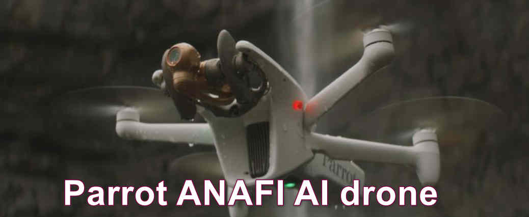
The Parrot ANAFI Ai is a professional drone whose defining feature is built-in 4G connectivity. Alongside Wi-Fi, its mobile-network connection is designed to support remote data links, live video and connected workflows. Add a 48 MP camera, automated photogrammetry options and a developer-focused software ecosystem, and the ANAFI Ai becomes a specialised platform for inspection, mapping and integration projects rather than a simple recreational camera drone.
Review scope: This is a research-based editorial overview using Parrot’s published documentation. It is not a hands-on test. Network performance, flight endurance and mission capability depend on the region, carrier coverage, setup, environment, software version and applicable aviation permissions.
Parrot ANAFI Ai at a glance
- Camera: 1/2-inch 48 MP CMOS sensor with HDR imaging.
- Video: 4K UHD up to 30fps, with HDR10 modes listed by Parrot.
- Zoom: up to 6x; Parrot lists lossless zoom up to 4x at 1080p and 2x at 4K.
- Connectivity: integrated 4G module and Wi-Fi, with automatic network switching.
- Maximum flight time: up to 32 minutes in manufacturer conditions.
- Weight: approximately 898 g.
- Software: FreeFlight 7 and Parrot’s SDK and developer tools.
- Navigation: GPS, GLONASS and Galileo, with additional onboard sensors.
Camera and imaging: 48 MP with HDR
The ANAFI Ai uses a 1/2-inch 48 MP CMOS sensor and a 24 mm-equivalent lens. Parrot lists a 14 EV dynamic range in HDR mode, 48 MP and 12 MP photo options, JPEG and DNG formats, and 4K UHD video. HDR can help preserve detail across bright and dark areas, although exposure, lighting, movement and post-production still affect the final result.
The zoom specification needs context. The camera offers up to 6x zoom, but Parrot identifies only part of that range as lossless: up to 4x at 1080p and 2x at 4K. Digital magnification beyond those limits should not be confused with optical zoom. For inspection, operators should test whether the required detail is genuinely resolvable at the intended distance and lighting conditions.

4G connectivity: the main differentiator
Unlike many camera drones that rely mainly on a direct radio link, the ANAFI Ai includes a 4G module as well as Wi-Fi. Parrot describes automatic switching between the available links and low-latency 1080p streaming. This can be useful for supported remote operations where mobile coverage is reliable.
There are important limits. A 4G connection depends on compatible network bands, a working SIM or service arrangement, coverage, congestion and latency. Connectivity does not remove the need for a safe command link or make a flight legal. A network connection alone does not authorise beyond-visual-line-of-sight (BVLOS) operation. BVLOS requires specific approvals and procedures where applicable. Operators must follow the rules of the country and airspace in which they fly.
Detailed Parrot ANAFI Ai specifications
| Specification | Parrot-published information |
|---|---|
| Aircraft weight | Approx. 898 g |
| Folded dimensions | 304 × 130 × 118 mm |
| Unfolded dimensions | 320 × 440 × 118 mm |
| Maximum flight time | 32 minutes |
| Maximum horizontal speed | 16 m/s (Parrot’s technical specifications) |
| Maximum vertical speed | 4 m/s |
| Maximum wind resistance | 14 m/s in flight; 12 m/s for take-off and landing |
| Service ceiling | 5,000 m above sea level |
| Operating temperature | -10°C to 40°C |
| Camera sensor | 1/2-inch 48 MP CMOS |
| Lens | 24 mm-equivalent, f/2.0 |
| Dynamic range | 14 EV in HDR mode (manufacturer claim) |
| Video | 4K UHD 3840 × 2160 at 24/25/30fps; HDR modes listed by Parrot |
| Photos | 48 MP or 12 MP; JPEG and DNG |
| Zoom | Up to 6x; lossless up to 4x at 1080p and 2x at 4K |
| Stabilisation | 3-axis mechanical and 3-axis electronic stabilisation |
| Connectivity | Wi-Fi and integrated 4G |
| Navigation | GPS, GLONASS and Galileo |
| Battery | 6,800 mAh, 4.4 V; approx. 366 g |
Specification note: Figures are drawn from Parrot’s published technical documentation. Maximum values are not guaranteed in normal missions. Published Parrot pages may describe protection ratings differently across documentation sections and revisions; check the current manual and exact aircraft documentation before relying on a weather-protection rating. Never treat the aircraft as waterproof.
Autonomous flight, mapping and developer tools
Parrot lists automated photogrammetry patterns such as single-grid, double-grid and orbit missions, as well as waypoint and point-of-interest planning. The aircraft’s software ecosystem includes FreeFlight 7, Air SDK, Ground SDK, OpenFlight, Sphinx and Olympe. These tools may appeal to organisations that want to integrate drone missions, telemetry or captured data into their own applications and workflows.
Automated flight does not guarantee a survey result. Image overlap, flight height, camera angle, lighting, wind, ground control, processing software and quality checks all influence the output. Before deploying it for paid mapping work, test the full workflow against the accuracy and deliverable requirements of the project.

Flight performance, battery and durability
Parrot lists up to 32 minutes of flight time and a 6,800 mAh smart battery weighing approximately 366 g. Treat 32 minutes as a manufacturer maximum rather than the time available for productive inspection or mapping. Wind, temperature, network use, flight profile, battery age and reserve requirements affect the actual mission window.
Plan battery rotations, charging, landing zones and safe return margins before launch. For professional use, also consider replacement battery availability, service arrangements, transport protection and the cost of maintaining the whole system.

Parrot ANAFI Ai compared with a conventional camera drone
| Decision factor | ANAFI Ai | Typical consumer camera drone |
|---|---|---|
| Connectivity | Integrated 4G plus Wi-Fi | Usually a direct radio link; features vary by model |
| Primary audience | Professional inspection, mapping and integration teams | Hobby pilots and photo/video creators |
| Software ecosystem | Parrot SDK and developer tools | Usually a more closed, ready-to-use consumer app workflow |
| Camera priorities | 48 MP imaging, HDR and zoom options for professional documentation | Varies widely; some consumer models offer larger sensors or more camera choices |
| Buying decision | Evaluate network coverage, software integration and mission requirements | Evaluate ease of use, camera quality, portability and price |
This is a category comparison, not a claim that the ANAFI Ai outperforms every consumer drone. If your work does not need 4G connectivity, SDK integration or automated mapping, a simpler camera drone may deliver better value.
Pros and cons
Advantages
- Integrated 4G connectivity alongside Wi-Fi is a distinctive capability for supported connected workflows.
- 48 MP still photography, HDR and DNG capture provide useful imaging options.
- Parrot lists 4K video and zoom features, with clear lossless zoom limits by resolution.
- Automated photogrammetry modes can support repeatable mapping missions.
- SDK and developer tools offer integration options for professional users.
Limitations
- 4G performance depends on local network coverage, service availability and carrier compatibility.
- Connectivity does not itself grant permission for BVLOS flights.
- 32 minutes is a maximum manufacturer figure; productive mission time is lower.
- Digital zoom beyond the lossless range reduces detail compared with true optical magnification.
- Its professional feature set may be unnecessary for casual photography and can increase the total cost of ownership.
Who should consider the Parrot ANAFI Ai?
Potentially suitable: inspection organisations, mapping teams, developers and operators who specifically need 4G connectivity, automated missions or Parrot’s software integration tools.
Probably not the best fit: casual recreational pilots, first-time drone owners and creators who mainly want a simple travel camera drone. Those buyers should compare consumer models based on camera quality, ease of use, portability, local support and total price.
Buying advice before ordering
- Check whether the 4G bands and network services are supported by a carrier in the country and worksite where you will fly.
- Confirm SIM, data-plan, controller, software and cloud-service requirements with the supplier.
- Ask for a demonstration of the actual mapping or inspection workflow you need.
- Confirm the current software version, SDK support and compatibility with your processing tools.
- Check battery supply, spare parts, repair options, warranty and local technical support.
- Ask the supplier to confirm the exact aircraft revision and current protection rating in its documentation.
- Review local drone permissions, privacy rules, data-security policies and BVLOS requirements before planning operations.
Price and availability
Professional drone prices and package contents vary by country and reseller. A historic launch price is not a reliable current quote. Request a written quotation that identifies the aircraft, controller, batteries, software, connectivity costs, warranty and support included.
Final verdict
The Parrot ANAFI Ai stands out because it combines 4G connectivity, a 48 MP camera, automated mapping options and developer tools in one professional platform. Those features can be valuable when they solve a real operational problem. If you do not need connected workflows or software integration, compare less specialised drones before investing.
Explore more: Parrot ANAFI Ai specifications · Parrot drone comparison · Parrot drone catalogue.
Official sources and editorial note
Primary sources: Parrot ANAFI Ai technical specifications, camera documentation, connectivity documentation and flight performance documentation. Manufacturer information can change; verify the current product documentation and local rules before purchase or operation. This article is a research-based editorial overview, not a hands-on test.
Verified speed and protection-rating clarification (8 November 2026)
Parrot lists up to 17 m/s forward and 16 m/s backward and laterally; 16 m/s should not be presented as the only maximum horizontal speed. Parrot’s flight-performance page identifies IPX3 rain resistance, while other ANAFI Ai documentation has used IP53 wording. These ratings are not interchangeable: IPX3 does not specify dust protection, whereas IP53 includes a dust-protection level. Follow the manual supplied for the exact aircraft revision; do not call it waterproof. The 32-minute endurance is a manufacturer maximum. 4G connectivity does not itself authorise BVLOS operation. Sources: Parrot ANAFI Ai flight performance and technical specifications.
Professional buyer suitability: when the ANAFI Ai makes sense
The ANAFI Ai should be shortlisted when a project has a defined need for integrated 4G connectivity, automated mission planning or software integration. For example, an inspection organisation may want to connect flight operations with its own asset-management platform, or a mapping team may need repeatable automated routes and a developer-accessible workflow. The value comes from the complete system—aircraft, controller, network service, software, payload workflow, data storage and support—not simply from the presence of a 4G modem.
For a small business that only needs occasional roof photographs, a conventional camera drone may be simpler and less costly. The ANAFI Ai’s specialist features are worth paying for only when the organisation can use them and has the staff, connectivity and approvals to operate them reliably.
4G connectivity: procurement questions
- Which LTE bands and network technologies are supported by the exact aircraft version?
- Which local mobile operators provide reliable coverage at the actual work sites, including rural or industrial areas?
- Is a SIM, subscription, data plan or cloud service required, and who pays recurring charges?
- What happens when the mobile network is congested, unavailable or interrupted during a mission?
- Can the aircraft fall back to the direct radio/Wi-Fi link, and what are the documented operating limits?
- Where are live video, telemetry and mission data processed and stored? Can the organisation meet its security and data-residency requirements?
4G is not a guarantee of uninterrupted command or video. Coverage maps are estimates; test connectivity at the intended site and at the intended altitude and route. A cellular link does not itself authorise beyond-visual-line-of-sight flight. BVLOS operations require the applicable aviation approvals, risk assessment, procedures and supporting systems.
Inspection, mapping and software integration
For inspection, define the minimum detail needed to identify a defect and test whether the camera can resolve it from a safe stand-off distance. For mapping, define the required ground-sampling distance, overlap, coordinate system, ground-control strategy and acceptance tolerance. Parrot’s automated flight modes can help standardise capture, but they do not replace survey design, calibration, ground checks or quality assurance.
For developers, review the current SDK documentation, supported firmware, APIs, maintenance status and sample integration before making the aircraft a dependency in a business-critical system. Confirm who owns custom code, how software updates are tested, and what happens if a vendor service or mobile network becomes unavailable.
Alternatives and procurement trade-offs
Conventional camera drone: a better fit when the main task is visual documentation and the organisation does not need cellular connectivity or SDK integration. Compare camera quality, zoom, flight time, service and price.
Enterprise platform with interchangeable payloads: may be preferable when thermal, zoom, mapping or other specialist sensors are central to the work. Confirm payload availability and compatibility, total aircraft weight and operator training.
Docked or remotely managed drone system: may suit repeat inspections at fixed sites, but introduces infrastructure, network, site-security, maintenance and regulatory requirements. Compare the complete operational model rather than the aircraft alone.
Ownership cost and supplier due diligence
Request a written quotation that separates aircraft, controller, batteries, charging equipment, connectivity, software subscriptions, training, warranty, repairs and replacement parts. Ask for the local service turnaround, battery replacement lead time and the process for firmware support. If the system is used or old stock, request battery cycle/health information, flight logs and a full demonstration of the intended network and software workflow.
Regional and legal operating checks
India: check DGCA requirements and Digital Sky airspace restrictions, including the applicable aircraft registration, remote-pilot, operating-category and permission requirements. Verify whether the cellular configuration and intended data flows meet organisational and applicable telecom/security requirements. Do not assume a 4G link makes remote or BVLOS operation permissible.
United States: determine the relevant FAA operating pathway, registration, Remote ID and airspace authorisations. Part 107 applies to most commercial operations, with additional approvals for operations outside standard limits. Cellular connectivity does not replace those approvals.
European Union: assess the applicable EASA operational category and national rules. A professional use case may require a Specific-category authorisation and an operational risk assessment. Check operator registration, pilot competency, geo-zones, privacy and data-protection obligations.
These are general prompts for compliance planning, not legal advice. Obtain advice from the relevant aviation authority or qualified compliance professional for the actual operation.
How IGIDRONE evaluated the platform
This article is a research-based overview using Parrot’s published product and developer documentation. IGIDRONE has not conducted a hands-on flight, network-coverage or mapping-accuracy test. Suitability statements are procurement analysis; they are not claims of personal field experience. Confirm current software, carrier compatibility, parts availability and support commitments in writing before purchase.
ANAFI Ai procurement: test the whole 4G workflow
For professional buyers, 4G connectivity is useful only when the complete operating environment supports it. Check cellular coverage at launch and along the planned operating area, SIM and data-plan availability, roaming restrictions, network security requirements, controller workflow and what happens when cellular service drops. A published connectivity feature does not itself grant permission for beyond-visual-line-of-sight operation.
For inspection or mapping, request representative sample files and confirm that the camera, mapping software, coordinate reference system and reporting workflow meet the project’s requirements. Review cybersecurity, data storage location, access controls, software lifecycle, battery supply, repair turnaround and operator training. The review covers the platform and procurement questions; the Parrot ANAFI Ai profile provides the structured model record.
1 thought on “Parrot ANAFI Ai 4G Drone Overview: Imaging and Autonomous Flight”