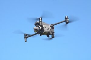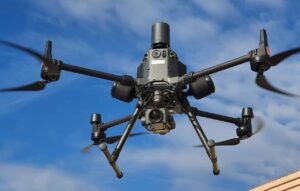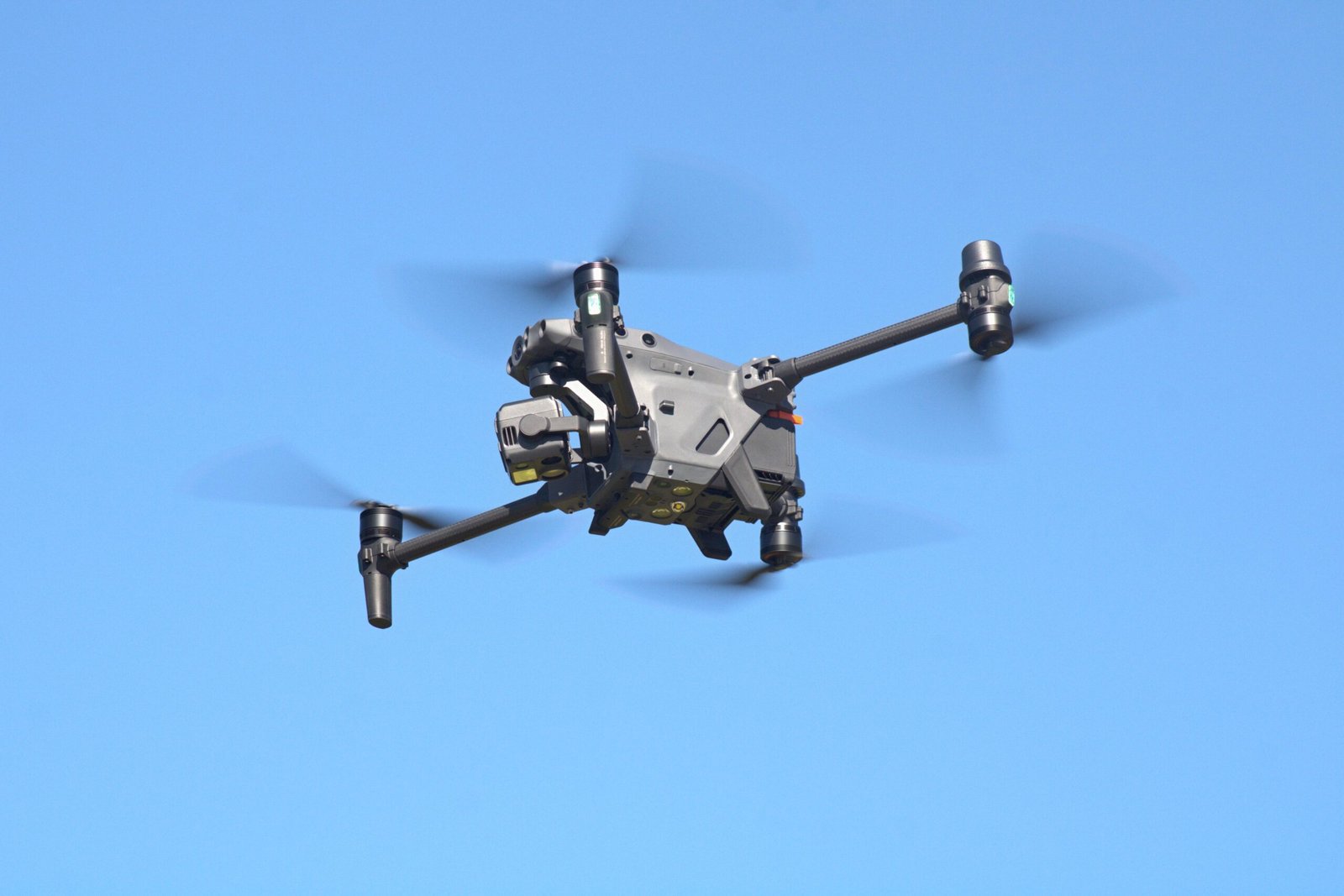
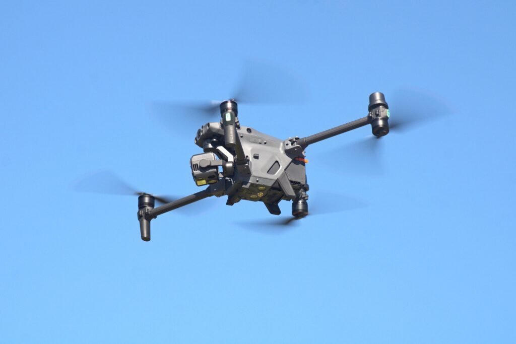
Photo: ZLEA · Licence: CC BY-SA 4.0 · View the original source and licence terms.
DJI / DRONE PROFILE
DJI Matrice 30T Review: Thermal Camera, Zoom and Laser Rangefinder
Explore the available technical information for this aircraft, including camera capabilities, flight performance and manufacturer-specific specifications.
The DJI Matrice 30T (M30T) is a compact enterprise drone designed for public safety, inspection and emergency response. It combines wide-angle and zoom cameras with a thermal camera and laser rangefinder in one integrated payload. The M30T is closely related to the Matrice 30, but it adds thermal imaging, making it the better fit when heat-pattern information is part of the mission.
Camera and thermal imaging
The M30T includes a 12MP wide camera, a 48MP zoom camera and an uncooled VOx thermal camera. The zoom camera uses a 1/2-inch CMOS sensor and a 113–405mm-equivalent focal-length range. The thermal camera has a 640×512 standard resolution, 12μm pixel pitch, 40mm-equivalent lens and 61° diagonal field of view. DJI also lists an infrared super-resolution mode up to 1280×1024. A laser rangefinder supports distance measurement from 3m to 1,200m under the stated target and environmental conditions.
Thermal readings are affected by emissivity, distance, reflections and weather. The manufacturer accuracy figure is conditional; trained operators should follow the thermal measurement guidance and use appropriate interpretation and reporting procedures.
Flight performance and durability
DJI lists the aircraft weight at approximately 3,770g including two batteries and maximum takeoff weight at 4,069g. Maximum flight time is 41 minutes and maximum hovering time is 36 minutes in the manufacturer’s stated conditions. The aircraft has an IP55 rating, RTK positioning support and O3 Enterprise transmission. The IP rating can decrease with wear and does not remove the need to follow DJI’s weather restrictions.
DJI Matrice 30T specifications
| Specification | Matrice 30T |
|---|---|
| Weight with two batteries | 3,770 ± 10g |
| Maximum takeoff weight | 4,069g |
| Maximum flight time | 41min (DJI test conditions) |
| Maximum hover time | 36min (DJI test conditions) |
| Ingress protection | IP55 |
| Wide camera | 1/2-inch CMOS, 12MP |
| Zoom camera | 1/2-inch CMOS, 48MP; 113–405mm equivalent |
| Thermal camera | VOx, 640×512 standard; 1280×1024 super-resolution mode |
| Thermal pixel pitch | 12μm |
| Laser rangefinder | 3–1,200m (specified target conditions) |
| RTK positioning | 1cm + 1ppm horizontal; 1.5cm + 1ppm vertical |
| Wind resistance | 12m/s |
Matrice 30T vs Matrice 30
The M30T adds the thermal camera to the shared wide/zoom camera and laser-rangefinder system. The standard M30 does not include the thermal camera. If thermal inspection is not required, read the DJI Matrice 30 review and compare the complete mission requirements before choosing.
Who should consider the M30T?
The M30T is aimed at emergency services, public-safety teams and industrial operators who need visible, zoom and thermal imaging in a portable enterprise aircraft. Buyers should assess the controller, battery set, charging equipment, software, RTK correction workflow and local service support as part of the system.
Official source and specification notes
Specifications are based on DJI’s official Matrice 30 Series specifications. The thermal camera belongs to the M30T, not the standard M30. Flight-time, thermal accuracy and laser-range values depend on the stated test conditions. This is a specification-based review, not a claim of hands-on testing.
Related IGIDRONE reading
Compare this aircraft with related enterprise models: DJI Matrice 30 review | DJI Matrice 350 RTK review.
Thermal measurement, dimensions and speed
The M30T thermal camera has a NETD rating of ≤50mK at f/1.0. DJI specifies infrared temperature measurement accuracy of ±2°C or ±2%, whichever is greater, with a high-gain measurement range of -20°C to 150°C; low gain covers 0°C to 500°C. The aircraft measures 470 × 585 × 215mm unfolded (excluding propellers) and 365 × 215 × 195mm folded. Maximum horizontal speed is 23m/s, with maximum ascent and descent speeds of 6m/s and 5m/s. These figures are manufacturer specifications and depend on the stated operating conditions.
Thermal images are useful for locating temperature patterns, but they do not automatically establish the cause of a hot or cold area. For inspection reports, consider emissivity, reflected heat, distance, angle, weather and the camera’s measurement settings. Use qualified thermography procedures where decisions depend on precise temperatures.
Who should choose the Matrice 30T?
The M30T is best evaluated as a field-response and inspection system rather than as a camera drone for casual aerial photography. Its integrated visible, zoom, thermal and laser-ranging sensors can reduce the need to swap payloads in time-sensitive operations. That integration is useful for public-safety teams, infrastructure inspection, emergency assessment and organisations that need a compact aircraft deployed by a small crew.
Thermal imaging: practical limits
A thermal camera shows apparent surface-temperature patterns; it does not automatically identify a fault or provide laboratory-grade temperature measurement. Emissivity, reflected heat, viewing angle, distance, weather, focus and scene conditions can change interpretation. Operators should use suitable temperature ranges and measurement settings, capture visual context, and treat thermal anomalies as items for investigation rather than definitive diagnoses. For critical inspections, follow the asset owner’s inspection protocol and have qualified personnel interpret the data.
Trade-offs and alternatives
The M30T’s integrated payload is convenient, but it offers less payload flexibility than a larger modular enterprise aircraft. Teams that need specialist LiDAR, photogrammetry or interchangeable sensors should compare it with the Matrice 350 RTK and the cost of the required payloads. Teams that mainly need thermal imaging in a smaller package should also compare the Mavic 3 Thermal family, while checking camera performance, weather protection, deployment needs, controller compatibility and support availability.
Procurement and fleet checklist
- Confirm the exact M30T package, controller, batteries, charging case, spotlight or speaker accessories, and any service plan.
- Check battery health, cycle history, storage condition and charging behaviour; field endurance is lower than a laboratory maximum.
- Confirm whether the intended operation requires a thermal radiometric workflow, zoom detail, laser range measurement or all three.
- Test data export, evidence retention, user permissions and secure handling of sensitive public-safety or infrastructure imagery.
- Check local aviation rules, operator qualifications, airspace permissions, privacy rules and any restrictions on thermal or critical-infrastructure data.
Editorial note
This is a research-based buyer guide, not a hands-on field test. Manufacturer specifications and advertised endurance should be treated as test-condition figures; actual results depend on environment, battery condition and mission profile.
Drone Specifications
| Brand | DJI |
|---|---|
| Camera | 12 MP wide + 48 MP zoom + thermal imager + laser rangefinder |
| Maximum Flight Time (minutes) | 41 min (maximum, DJI test conditions) minutes |
| Weight (g) | 3770 g |
| Wind Resistance (m/s) | 12 m/s m/s |
| Obstacle Sensing | Omnidirectional vision and infrared sensing |
| Positioning / GPS | GPS, Galileo, BeiDou; GLONASS with RTK module |
| Maximum Speed (m/s) | 23 m/s m/s |
Additional Notes
Matrice 30T review entry: approx. 3,770 ±10 g with two batteries; max takeoff weight 4,069 g; 41 min max flight time; IP55. Thermal camera and laser rangefinder are integrated. RTK fixed accuracy 1 cm + 1 ppm horizontal / 1.5 cm + 1 ppm vertical.
Specification source: Official source
Last verified: 2026-11-07
Official Price (USD)
No public USD price was verified on the manufacturer’s official store during this check.
For enterprise or discontinued models, contact the manufacturer for a current quotation. We do not substitute third-party seller prices.
Price checked: 2026-11-07
MODEL TECHNICAL RECORD
Detailed Technical Specifications
Manufacturer-specific technical information recorded for this model. Values not present in the source record are not estimated.
Aircraft
| Weight with two batteries | 3770 ± 10 g |
|---|---|
| Max Takeoff Weight | 4069 g |
| Max Flight Time | 41 min (DJI test) |
| Max Hover Time | 36 min (DJI test) |
| Max Wind Resistance | 12 m/s |
| Ingress Protection Rating | IP55 |
| RTK Positioning Accuracy | 1 cm + 1 ppm horizontal; 1.5 cm + 1 ppm vertical |
Wide Camera
| Sensor | 1/2-inch CMOS, 12 MP |
|---|---|
| Lens | 24 mm equivalent, f/2.8 |
Zoom Camera
| Sensor | 1/2-inch CMOS, 48 MP |
|---|---|
| Lens | 113–405 mm equivalent, f/2.8–f/4.2 |
Thermal Camera
| Sensor | Uncooled VOx, 640×512 standard; 1280×1024 super-resolution mode |
|---|---|
| Pixel Pitch | 12 μm |
| Lens | 40 mm equivalent, f/1.0 |
Laser Rangefinder
| Measurement Range | 3–1200 m under specified target conditions |
|---|


Aircraft & Flight
| Maximum horizontal speed | 23 m/s |
|---|---|
| Maximum takeoff weight | 4069 g (EU C2 limit: 3998 g) |
Navigation & Obstacle Sensing
| Supported GNSS systems | GPS + Galileo + BeiDou + GLONASS (GLONASS supported when RTK module is enabled) |
|---|
Operating Conditions & Dimensions
| Maximum wind resistance | 12 m/s |
|---|
MANUFACTURER DATA
Detailed official specifications
Technical figures below are transcribed from the manufacturer documentation linked with this profile. Test figures are maximum or controlled-condition ratings where stated; actual performance varies by configuration and operating conditions. A field is omitted when the cited source does not publish a reliable value.
Manufacturer source last checked: 2026-11-07
Evidence type: Official manufacturer specifications / support documentation
Aircraft
| Dimensions(unfolded, excl. propellers) | 470 × 585 × 215 mm (L × W × H) |
|---|---|
| Dimensions (folded) | 365 × 215 × 195 mm (L × W × H) |
| Diagonal Wheelbase | 668 mm |
| Weight (incl. two batteries) | 3770 ± 10 g |
| Maximum takeoff weight | 4069 g |
| Max Takeoff Weight for C2 Certification in EU | 3998 g |
| Operation Frequency | 2.4000-2.4835 GHz; 5.725-5.850 GHz |
| Transmitter Power (EIRP) | 2.4 GHz: <33 dBm (FCC); <20 dBm (CE/SRRC/MIC)5.8 GHz: <33 dBm (FCC/SRRC); <14 dBm (CE) |
| Hovering Accuracy(windless or breezy) | Vertical: ±0.1 m (Vision System enabled); ±0.5 m (N-mode with GPS); ±0.1 m (RTK)Horizontal: ±0.3 m (Vision System enabled); ±1.5 m (N-mode with GPS); ±0.1 m (RTK) |
| RTK Positioning Accuracy(fixed RTK enabled) | 1 cm+1 ppm (horizontal)1.5 cm+1 ppm (vertical) |
| Max Angular Velocity | Pitch: 150°/sec.; Yaw: 100°/sec. |
| Max Pitch Angle | 35° (N-mode and Forward Vision System enabled: 25°) |
| Max Ascent/Descent Speed | 6 m/s, 5 m/s |
| Max Tilt Descent Speed | 7 m/s |
| Maximum horizontal speed | 23 m/s |
| Max Service Ceiling Above Sea Level (without other payload) | 5,000 m (with 1671 propellers)7,000 m (with 1676 propellers) |
| Maximum wind resistance | 12 m/s |
| Max Hover Time | 36 min |
| Maximum flight time | 41 min |
| Motor Model | 3511 |
| Propeller Model | 16711676 High Altitude (not included) |
| Ingress Protection Rating | IP55 |
| Global navigation satellite system (GNSS) | GPS+Galileo+BeiDou+GLONASS(GLONASS is supported only when RTK module is enabled) |
| Operating temperature range | -20° to 50°C (-4° to 122° F) |
| Class | C2 (EU) |
Gimbal
| Angular Vibration Range | ±0.01° |
|---|---|
| Controllable Range | Pan: ±90°Tilt: -120° to +45° |
| Mechanical Range | Pan: ±105°Tilt: -135° to +60°Roll: ±45° |
Zoom Camera
| Sensor | 1/2" CMOS, Effective pixels: 48M |
|---|---|
| Lens | Focal length: 21-75 mm (equivalent: 113-405 mm)Aperture: f/2.8-f/4.2Focus: 5 m to ∞ |
| Exposure Compensation | ±3 ev (using 1/3 ev as step length) |
| Electronic Shutter Speed | Auto Mode:Photo: 1/8000-1/2 sVideo: 1/8000-1/30 sM Mode:Photo: 1/8000-8 s Video: 1/8000 -1/30 s |
| ISO Range | 100-25600 |
| Max. Video Resolution | 3840 × 2160 |
| Max Photo Size | 8000 × 6000 |
Wide Camera
| Sensor | 1/2" CMOS, Effective pixels: 12M |
|---|---|
| Lens | DFOV: 84°Focal length: 4.5 mm (equivalent: 24 mm)Aperture: f/2.8Focus: 1 m to ∞ |
| Exposure Compensation | ±3 ev (using 1/3 ev as step length) |
| Electronic Shutter Speed | Auto Mode: Photo: 1/8000-1/2 s Video: 1/8000-1/30 s M Mode: Photo: 1/8000-8 s Video: 1/8000-1/30 s |
| ISO Range | 100-25600 |
| Max. Video Resolution | 3840 × 2160 |
| Photo Size | 4000 × 3000 |
Thermal Camera
| Thermal Imager | Uncooled VOx Microbolometer |
|---|---|
| Lens | DFOV: 61°Focal length: 9.1 mm (equivalent: 40 mm)Aperture: f/1.0Focus: 5 m to ∞ |
| Noise Equivalent Temperature Difference (NETD) | ≤50 mK@F1.0 |
| Infrared Temperature Measurement Accuracy | ±2°C or ±2% (using the larger value) |
| Video Resolution | Infrared Image Super-resolution Mode: 1280 × 1024Normal Mode: 640 × 512 |
| Photo Size | Infrared Image Super-resolution Mode: 1280 × 1024Normal Mode: 640 × 512 |
| Pixel Pitch | 12 um |
| Temperature Measurement Method | Spot Meter, Area Measurement |
| Temperature Measurement Range | High Gain Mode: -20° to 150°C (-4° to 302° F)Low Gain Mode: 0° to 500°C (32° to 932° F) |
| Temperature Alert | Supported |
| Palette | White Hot/Black Hot/Tint/Iron Red/HotIron/Arctic/Medical/Fulgurite/Rainbow 1/Rainbow 2 |
FPV Camera
| Resolution | 1920 × 1080 |
|---|---|
| DFOV | 161° |
| Frame Rate | 30 fps |
Laser Module
| Wavelength | 905 nm |
|---|---|
| Max Laser Power | 3.5 mW |
| Single Pulse Width | 6 ns |
| Measurement Accuracy | ± (0.2 m + D × 0.15%)D is the distance to a vertical surface |
| Measuring Range | 3-1,200 m (0.5 × 12 m vertical surface with 20% reflectivity) |
| Safety Regulation Level | Class 1M |
| Accessible Emission Limit (AEL) | 304.8 nJ |
| Reference Aperture | 18mm length, 18mm width (20.3mm diameter if equivalent to circular) |
| Max Laser Pulse Emission Power Within 5 Nanoseconds | 60.96 W |
Vision Systems
| Obstacle Sensing Range | Forward: 0.6-38 mUpward/Downward/Backward/Sideward: 0.5-33 m |
|---|---|
| FOV | 65° (H), 50° (V) |
| Operating Environment | Surfaces with clear patterns and adequate lighting (> 15 lux) |
Infrared Sensing Systems
| Obstacle Sensing Range | 0.1 to 10 m |
|---|---|
| FOV | 30° |
| Operating Environment | Large, diffuse, and reflective obstacles (reflectivity >10%) |
TB30 Intelligent Flight Battery
| Capacity | 5880 mAh |
|---|---|
| Voltage | 26.1 V |
| Battery Type | Li-ion 6S |
| Energy | 131.6 Wh |
| Net Weight | Approx. 685 g |
| Operating temperature range | -20° to 50°C (-4° to 122° F) |
| Storage Temperature | 20° to 30°C (68° to 86° F) |
| Charging Temperature | -20° to 40°C (-4° to 104° F)(When the temperature is lower than 10°C (50° F), the self-heating function will be automatically enabled. Charging in a low temperature may shorten the lifetime of the battery) |
| Chemical System | LiNiMnCoO2 |
Auxiliary Lights
| Effective Illumination Distance | 5 m |
|---|---|
| Illumination Type | 60 Hz, solid glow |
Remote Controller
| Screen | 7.02 inch LCD touchscreen, with a resolution of 1920 × 1200 pixels, and high brightness of 1200 cd/m2 |
|---|---|
| Internal Battery | Type: Li-ion (6500 mAh @ 7.2 V)Charge Type: Supports battery station or USB-C charger maximum rated power 65W (max voltage of 20V)Charge Time: 2 hoursChemical System: LiNiCoAIO2 |
| External Battery(WB37 Intelligent Battery) | Capacity: 4920 mAhVoltage: 7.6 VBattery Type: Li-ionEnergy: 37.39 WhChemical System: LiCoO2 |
| Operating Time | Internal Battery: Approx. 3 hours 18 minInternal Battery + External Battery: Approx. 6 hours |
| Ingress Protection Rating | IP54 |
| Global navigation satellite system (GNSS) | GPS+Galileo+BeiDou |
| Operating temperature range | -20° to 50°C (-4° to 122° F) |
O3 Enterprise
| Operating Frequency | 2.4000-2.4835 GHz, 5.725-5.850 GHz |
|---|---|
| Max Transmission Distance (unobstructed, free of interference) | 15 km (FCC); 8 km (CE/SRRC/MIC) |
| Max Transmission Distance (with interference) | Strong Interference (urban landscape, limited line of sight, many competing signals): 1.5-3 km (FCC/CE/SRRC/MIC)Medium Interference (suburban landscape, open line of sight, some competing signals): 3-9 km (FCC); 3-6 km (CE/SRRC/MIC)Weak Interference (open landscape abundant line of sight, few competing signals): 9-15 km (FCC); 6-8 km (CE/SRRC/MIC) |
| Transmitter Power (EIRP) | 2.4 GHz: <33 dBm (FCC); <20 dBm (CE/SRRC/MIC)5.8 GHz: <33 dBm (FCC); <14 dBm (CE); <23 dBm (SRRC) |
Wi-Fi
| Protocol | Wi-Fi 6 |
|---|---|
| Operating Frequency | 2.4000-2.4835 GHz; 5.150-5.250 GHz; 5.725-5.850 GHz |
| Transmitter Power (EIRP) | 2.4 GHz: <26 dBm (FCC); <20 dBm (CE/ SRRC/MIC)5.1 GHz: <26 dBm (FCC); <23 dBm (CE/ SRRC/MIC)5.8 GHz: <26 dBm (FCC/SRRC); <14 dBm(CE) |
Bluetooth
| Protocol | Bluetooth 5.1 |
|---|---|
| Operating Frequency | 2.4000-2.4835 GHz |
| Transmitter Power (EIRP) | <10 dBm |
BS30 Intelligent Battery Station
| Dimensions | 353 × 267 × 148 mm |
|---|---|
| Net Weight | 3.95 kg |
| Compatible Battery Type | TB30 Intelligent Flight BatteryWB37 Intelligent Battery |
| Input | 100-240 VAC, 50/60 Hz |
| Output | TB30 Battery Port: 26.1 V, 8.9 A (supported up to two outputs simultaneously)WB37 Intelligent Battery: 8.7 V, 6 A |
| Output Power | 525 W |
| USB-C port | Max. output power of 65 W |
| USB-A port | Max. output power of 10 W (5 V, 2 A) |
| Power Consumption (when not charging battery) | < 8 W |
| Output Power (when warming up battery) | Approx. 30 W |
| Operating temperature range | -20° to 40°C (-4° to 104° F) |
| Ingress Protection Rating | IP55 (with the cover closed properly) |
| Charging Time | Approx. 30 min (charging two TB30 batteries from 20% to 90%)Approx. 50 min (charging two TB30 batteries from 0% to 100%) |
| Protection Features | Anti-Backflow ProtectionShort Circuit ProtectionOver Voltage ProtectionOver Current ProtectionTemperature Protection |
Other
| Footnotes | [1] 5.8 and 5.1GHz frequencies are prohibited in some countries. In some countries, the 5.1GHz frequency is only allowed for use indoors.[2] The maximum flight time and the hover time were tested in a lab environment and is for reference only.[3] This protection rating is not permanent and may reduce over time after long-term use.[4] Infrared temperature measurement accuracy was tested in a lab environment and is for reference only.[5] The maximum operating time was tested in a lab environment and is for reference only.[6] The charging time was tested in a lab environment at room temperature. The value provided should be used for reference only. |
|---|---|
| Guaranteed software updates until | 2024/12/31 |
Source: manufacturer technical specifications and official support documentation. Regional versions, payloads, batteries, firmware and test conditions can change the stated figures. Check the linked source for the applicable configuration.
Related Dji drones
Explore other published models from the same manufacturer.