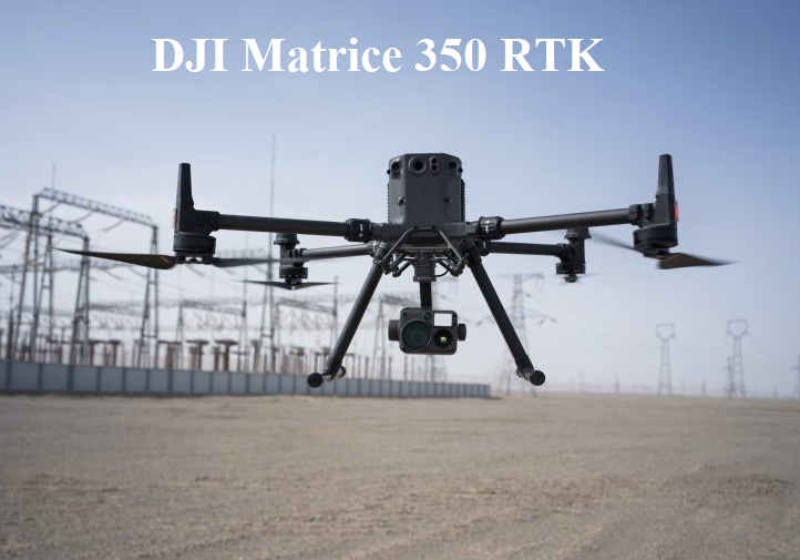
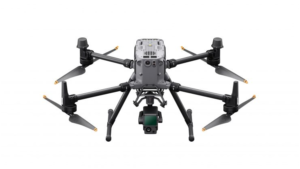
The drone making company DJI announced new drone which is DJI Matrice 350 RTK (M350 RTK). The DJI Matrice 350 RTK is a DJI upgraded version of drone that have safer, efficient for any tropical aerial operation in public safety, energy mapping, infrastructure and forestry, etc.

Alos read :- DJI Matrice 300 RTK
DJI MATRICE 350 RTK KEY FEATURES
- Up to 55 minutes of flight time (without payload).
- IP rating is IP55.
- operating temperature from -20°C to 50°C (-4° to 122° F).
- Highly versatile: Multi-payload support.
- Enhanced video transmission: four antenna O3 Enterprise transmission.
- Upgraded battery system, including 400 battery cycles.
- Six directional sensing and positioning.
- Hot-swappable battery.
- Arm lock indicator and night-vision FPV camera.
- Intelligent features for automated and precise data capture’
- Comes with the DJI RC Plus – DJI’s most advanced smart controller’
- Use with DJI’s cloud-based software, FlightHub 2.
DJI Matrice 350 RTK price
The price of DJI Matrice 350 RTK is $11,540, and with an external battery the price is $12,670.
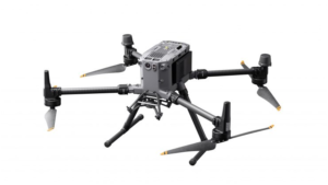
The New Matrice 350 RTK has advance feature it has a 55 minute maximum flight time and it has a 2.7 kg payload capacity. The DJI O3 Enterprise give to use a triple cameras to transmit live 1080 HD video up to 20 km. this transmission achieved with a four antenna transceiver system, to transmit the signals select the two antennas intelligently, while four antennas receive signal simultaneously.
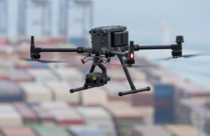
The anti interference is slightly improved and transmission stability optimized. The DJI improve IP rating from IP45 to IP55 and camera FPV are also enhanced for proving batter navigation visibility in night. It also provides alarm lock detection faction to avoid any obstruction during flight. DJI Matrice 350 rtk has 6-directional binocular vision system, and this feature provides an infrared sensing system in six-directional awareness, obstacle-sensing capabilities and positioning for batter and comprehensive protection during flight.
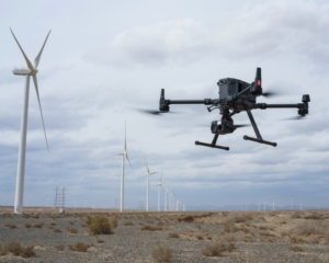
If you want further flight safety you can buy CSM radar separately and fixed on the top of drone and if offers 30 m range for subtle obstacles in 360° detection range. And furthermore, it is a more incorporates a multi layered design of drone and sensor for allowing more confident operations in harsh environments.
It comes with DJI RC plus 7-inch high bright screen, dual mode operation and an operating time is up to six hour with a standard WB37 external battery. It is a dust and water proof system and it can -20° to 50° C (-4° to 122° F) temperature.
The RC Plus’ app, Pilot 2, increase the efficiency of task from stating to end point. The intelligent functions are increasing the efficiency, safety of drone. The AI spot check are use form constantly inspections and capturing constant result every time and PinPoint can be use for quick mark of object and have its coordinates calculated and all cameras are projected to point, this feature useful in search and rescue operations.
The M350 RTK’s new has TB65 batteries which increase 100% battery cycle count and full charge up to 400 cycles. It dual battery system feature increase multiple flights without power drain and support battery hot swapping. When battery station is connected to DJI RC Plus, the DJI Pilot app shows the battery status.
The M350 RTK’s new has 2.7 kg payload capacity. These payload capacities are use in public safety, mapping and inspection etc.
Zenmuse H20 Series: The Zenmuse H20 Series cameras provide professionals with high-quality imaging and measurement capabilities for a wide range of applications. Whether it’s aerial inspections, mapping, public safety operations, or search and rescue missions, these camera payloads offer advanced features and versatility to enhance aerial imaging workflows.

The Zenmuse H20N camera is a pair with dual zoom thermal and laser range finder.

The Zenmuse P1 offers professionals in the mapping and surveying industry a high-quality aerial imaging solution with advanced features and precise data collection capabilities. With its full-frame sensor, mechanical shutter, and integration with DJI’s mapping software, it provides accurate and detailed results for a wide range of applications.

The Zenmuse L1 provides professionals in the mapping, surveying, and inspection industries with a powerful aerial solution for accurate and detailed 3D data collection. By combining lidar and camera capabilities, it offers a comprehensive solution for capturing, processing, and analyzing high-quality data for a wide range of applications, including infrastructure mapping, construction site monitoring, and land surveying.
With the PinPoint, high precision and cloud based real time mapping, it can be link to air to surface. After completing task it sent image to ground operator.

Payload SDK: Payload Software Development Kit (Payload SDK) is a development framework provided by DJI for third-party developers to create custom applications and software solutions that interact with and control DJI drone payloads. By utilizing the Payload SDK, developers can extend the capabilities of DJI drone payloads and create specialized applications that address specific industry needs. It empowers developers to build innovative solutions for aerial photography, videography, inspection, mapping, agriculture, and other industries that rely on drone-based payloads for data collection and analysis
Mobile SDK: Mobile SDK (Software Development Kit) is a development framework provided by DJI for third-party developers to create mobile applications that interact with and control DJI drones. The Mobile SDK enables developers to build custom functionalities, interfaces, and features for DJI drone applications on iOS and Android platforms.
Price & Availability
The DJI M350 RTK is available for purchase today from store.dji.com and DJI Enterprise Dealers.
IN THE BOX
- DJI Matrice 350 Aircraft
- DJI RC Plus
- Matrice 350 Carrying Case
- DJI Enterprise Care Basic
- DJI WB37 Intelligent Battery
- DJI BS65 Intelligent Battery Station
- DJI TB65 Intelligent Flight Battery ×2
- Matrice 350 Landing Gear x2
- Matrice 350 RTK 2110s Propellers (Pair)
- Cleaning Tools
- Screws and Tools
- Spare Gimbal Damper ×4
- Rubber Port Cover (Set)
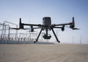
Specifications of Matrice 350 RTK
AIRCRAFT
- DIMENSIONS when UNFOLDED, WITHOUT PROPELLERS :- 810×670×430 mm (L×W×H).
- DIMENSIONS when FOLDED, WITH PROPELLERS :- 430×420×430 mm (L×W×H).
- DIAGONAL WHEELBASE:- 895 mm.
- WEIGHT WITH SINGLE DOWNWARD GIMBAL :- Without batteries: Approx. 3.77 kg.
:- With two TB65 batteries: Approx. 6.47 kg. - SINGLE GIMBAL DAMPER’S MAX PAYLOAD:- 960 g.
- MAX TAKEOFF WEIGHT:- 9.2 kg.
OPERATING FREQUENCY:-
- 4000-2.4835 GHz.
- 150-5.250 GHz (CE: 5.170-5.250 GHz).
- 725-5.850 GHz.
- In different country, the 5.1GHz and 5.8GHz frequency bands are prohibited, or the 5.1GHz frequency band is only allowed for indoor use.
TRANSMITTER POWER (EIRP) :-
- 4000-2.4835 GHz:
- < 33 dBm (FCC)
- < 20 dBm (CE/SRRC/MIC)
- 150-5.250 GHz (CE: 5.170-5.250 GHz):
- < 23 dBm (CE)
- 725-5.850 GHz:
- < 33 dBm (FCC/SRRC)
- < 14 dBm (CE)
HOVERING ACCURACY (WITH MODERATE OR NO WIND) :-
- Vertical:
- ±0.1 m (with vision positioning)
- ±0.5 m (with GNSS positioning)
- ±0.1 m (with RTK positioning)
- Horizontal:
- ±0.3 m (with vision positioning)
- 5 m (with GNSS positioning)
- ±0.1 m (with RTK positioning)
RTK POSITIONING ACCURACY (RTK FIX) :-
- 1 cm + 1 ppm (horizontal).
- 5 cm + 1 ppm (vertical).
MAX ANGULAR VELOCITY:-
- Pitch: 300°/s.
- Yaw: 100°/s.
MAX PITCH ANGLE :-
- 30°.
- 25°.
MAX ASCENT SPEED :- 6 m/s.
MAX DESCENT SPEED (VERTICAL) :- 5 m/s.
MAX TILTED DESCENT SPEED :- 7 m/s.
MAX HORIZONTAL SPEED :- 23 m/s.
MAX FLIGHT ALTITUDE :-
- 5000 m.
- for using the 2110s propellers and with the takeoff weight ≤ 7.4 kg.
- 7000 m.
- for using the 2112 High-Altitude Low-Noise Propellers and with the takeoff weight ≤ 7.2 kg.
MAX WIND SPEED RESISTANCE :- 12 m/s
MAX FLIGHT TIME :-
- 55 minutes.
- 8 m/s without payloads in a windless environment until the battery level reached 0%.
SUPPORTED DJI GIMBALS :-
- Zenmuse H20.
- Zenmuse H20T.
- Zenmuse H20N.
- Zenmuse P1.
- Zenmuse L1.
SUPPORTED GIMBAL CONFIGURATIONS :-
- Single downward gimbal.
- Single upward gimbal.
- Dual downward gimbals.
- Single downward gimbal + single upward gimbal.
- Dual downward gimbals + single upward gimbal.
INGRESS PROTECTION RATING :-
- IP55.
- The IP rating is not permanently effective and may decrease due to product wear and tear.
GLOBAL NAVIGATION SATELLITE SYSTEM :- GPS + GLONASS + BeiDou + Galileo.
OPERATING TEMPERATURE :- -20° to 50° C (-4° to 122° F).
REMOTE CONTROLLER
SCREEN :- LED touch screen 7.02-inch; max brightness: 1200 nits and resolution: 1920×1200;
WEIGHT :-
- 1.25 kg (without WB37 battery).
- 1.42 kg (with WB37 battery).
GLOBAL NAVIGATION SATELLITE SYSTEM :- GPS + Galileo + BeiDou.
BUILT-IN BATTERY :-
- Type: Li-ion (6500 mAh@7.2 V).
- Charging Type: Use the battery station or USB-C fast charger with a max power of 65 W (max voltage of 20 V).
- Charging Time: 2 hours.
- Chemical System: LiNiCoAlO2.
EXTERNAL BATTERY (WB37 INTELLIGENT BATTERY) :-
- Capacity: 4920 mAh.
- Voltage: 7.6 V.
- Type: Li-ion.
- Energy: 37.39 Wh.
- Chemical System: LiCoO2.
INGRESS PROTECTION RATING :- IP54.
OPERATING TIME :-
- Built-in Battery: approx. 3.3 hours.
- Built-in Battery + External Battery: approx. 6 hours.
OPERATING TEMPERATURE :- -20° to 50° C (-4° to 122° F).
OPERATING FREQUENCY :-
- 4000-2.4835 GHz.
- 725-5.850 GHz.
TRANSMITTER POWER (EIRP) :-
- 4000-2.4835 GHz:
- < 33 dBm (FCC)
- < 20 dBm (CE/SRRC/MIC)
- 725-5.850 GHz:
- < 33 dBm (FCC)
- < 14 dBm (CE)
- < 23 dBm (SRRC)
WI-FI PROTOCOL :- Wi-Fi 6.
WI-FI OPERATING FREQUENCY :-
- 4000-2.4835 GHz.
- 150-5.250 GHz.
- 725-5.850 GHz.
BLUETOOTH PROTOCOL :- Bluetooth 5.1.
BLUETOOTH OPERATING FREQUENCY :- 2.4000-2.4835 GHz.
VIDEO TRANSMISSION
VIDEO TRANSMISSION SYSTEM :- DJI O3 Enterprise Transmission.
ANTENNA :- 4 video transmission antennas, 2T4R.
MAX TRANSMISSION DISTANCE (UNOBSTRUCTED, FREE OF INTERFERENCE) :-
- 20 km (FCC).
- 8 km (CE/SRRC/MIC).
MAX TRANSMISSION DISTANCE (WITH INTERFERENCE)
- Low Interference and Obstructed by Buildings: approx. 0-0.5 km.
- Low Interference and Obstructed by Trees: approx. 0.5-3 km.
- Strong Interference and Unobstructed: urban landscape, approx. 1.5-3 km.
- Medium Interference and Unobstructed: suburban landscape, approx. 3-9 km.
- Low Interference and Unobstructed: suburb/seaside, approx. 9-20 km.
- Measured with FCC compliance in unobstructed environments with typical interference at a flight altitude of approximately 120 m.
VISION SYSTEM
OBSTACLE SENSING RANGE :-
- Forward/Backward/Left/Right: 0.7-40 m.
- Upward/Downward: 0.6-30 m.
FOV :-
- Forward/Backward/Downward: 65° (horizontal), 50° (vertical).
- Left/Right/Upward: 75° (horizontal), 60° (vertical).
OPERATING ENVIRONMENT :- Surfaces with discernible patterns and adequate lighting (lux > 15).
INFRARED SENSING SYSTEM
OBSTACLE SENSING RANGE :- 0.1-8 m.
FOV :- 30° (±15°).
OPERATING ENVIRONMENT :- Large, diffuse, and reflective obstacles (reflectivity > 10%).
LED AUXILIARY LIGHT
EFFECTIVE ILLUMINATION DISTANCE :- 5 m.
ILLUMINATION TYPE :- 60 Hz, solid glow.
FPV CAMERA
RESOLUTION :- 1080p.
FOV :- 142°.
FRAME RATE :- 30fps.
INTELLIGENT FLIGHT BATTERY
MODEL :- TB65.
CAPACITY :- 5880 mAh.
VOLTAGE :- 44.76 V.
TYPE :- Li-ion.
ENERGY :- 263.2 Wh.
WEIGHT :- Approx. 1.35 kg.
OPERATING TEMPERATURE :- -20° to 50° C (-4° to 122° F).
IDEAL STORAGE TEMPERATURE :- 22° to 30° C (71.6° to 86° F).
CHARGING TEMPERATURE :- -20° to 40° C (-4° to 104° F).
CHARGING TIME :-
- With a 220V power supply, it takes approximately 60 minutes to fully charge two TB65 Intelligent Flight Batteries.
- With a 110V power supply, it takes approximately 70 minutes to fully charge two TB65 Intelligent Flight Batteries.
INTELLIGENT BATTERY STATION
DIMENSIONS :- 580×358×254 mm (L×W×H).
NET WEIGHT :- Approx. 8.98 kg.
COMPATIBLE STORED ITEMS :-
- Eight TB65 Intelligent Flight Batteries.
- Four WB37 Intelligent Batteries.
INPUT VOLTAGE :-
- 100-120 VAC, 50-60 Hz.
- 220-240 VAC, 50-60 Hz.
MAX INPUT POWER :- 1070 W.
OUTPUT POWER :-
- 100-120 V: 750 W.
- 220-240 V: 992 W.
OPERATING TEMPERATURE :- -20° to 40° C (-4° to 104° F).

