

DJI / DRONE PROFILE
DJI Mavic 3 Multispectral Review: Precision Agriculture and Crop Mapping
Explore the available technical information for this aircraft, including camera capabilities, flight performance and manufacturer-specific specifications.
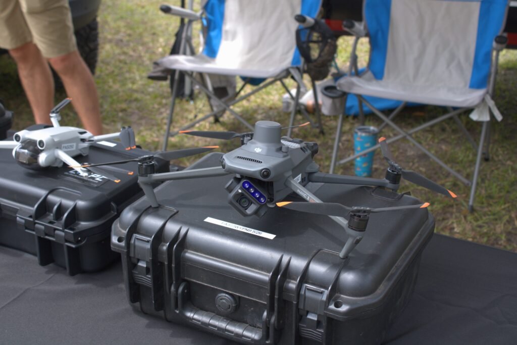
The DJI Mavic 3 Multispectral (Mavic 3M) is a compact enterprise drone designed for precision agriculture, crop monitoring and environmental surveying. It combines a 20MP RGB camera with four dedicated 5MP multispectral cameras, allowing operators to collect visible and spectral data during the same mission. It is a specialist mapping aircraft, not simply a standard Mavic 3 with a different camera.
RGB and multispectral imaging
The RGB camera uses a 4/3 CMOS sensor with 20MP effective pixels, a 24mm-equivalent lens and an adjustable f/2.8–f/11 aperture. DJI lists a mechanical shutter with a fastest speed of 1/2000s. The multispectral system contains four 1/2.8-inch CMOS sensors, each with 5MP resolution, capturing green, red, red-edge and near-infrared bands. The band centres are 560nm, 650nm, 730nm and 860nm.
These spectral bands can be used to calculate vegetation indices such as NDVI, GNDVI and NDRE. The drone also includes a sunlight sensor to record solar irradiance information for more consistent data processing. The resulting imagery still needs suitable mapping software and interpretation; it does not independently diagnose crop disease or nutrient problems.
RTK positioning and field coverage
The Mavic 3M includes an RTK module and supports centimetre-level positioning when a suitable correction source is available and the system is properly configured. DJI promotes the aircraft for efficient aerial surveying and cites coverage up to 200 hectares per flight under specified conditions. Actual area covered depends on altitude, overlap, terrain, wind, battery reserve and the required ground sample distance.
Flight performance
DJI lists a net weight of 951g with propellers and RTK module, and a maximum takeoff weight of 1,050g. Maximum flight time is 43 minutes in a no-wind test. The listed maximum wind resistance is 12m/s and maximum service ceiling is 6,000m without payload. The aircraft uses DJI O3 Enterprise transmission and supports omnidirectional obstacle sensing, subject to lighting and surface conditions.
DJI Mavic 3M specifications
| Specification | Mavic 3 Multispectral |
|---|---|
| Weight with propellers and RTK module | 951g |
| Maximum takeoff weight | 1,050g |
| RGB camera | 4/3 CMOS, 20MP |
| RGB lens | 24mm equivalent, f/2.8–f/11 |
| Multispectral cameras | Four 1/2.8-inch CMOS sensors, 5MP each |
| Spectral bands | Green 560nm; Red 650nm; Red Edge 730nm; NIR 860nm |
| Max flight time | 43min (DJI test conditions) |
| Max flight distance | 32km (DJI test conditions) |
| Wind resistance | 12m/s |
| Positioning | GNSS + RTK |
| Video transmission | DJI O3 Image Transmission Industry Edition |
Advantages and limitations
Advantages
- Combines high-resolution RGB imagery with four multispectral bands.
- RTK positioning and sunlight sensing support repeatable agricultural surveys.
- Mechanical shutter on the RGB camera helps with mapping capture.
- Compact folding design compared with larger agricultural survey aircraft.
Limitations
- Requires specialist processing software and an agricultural data workflow.
- Not designed for general-purpose cinematic video or casual photography.
- RTK benefits depend on correction data and proper configuration.
- Coverage and flight-time claims are manufacturer test values, not guaranteed field results.
Who should consider the Mavic 3M?
The Mavic 3M is aimed at agronomists, agricultural service providers, researchers and land managers who need repeatable multispectral imagery. It makes most sense when the organisation has a plan for flight planning, image processing, vegetation-index analysis and turning the resulting maps into field decisions.
Official source and verification notes
Specifications are based on DJI’s official Mavic 3 Multispectral product information and Mavic 3M specifications. The four multispectral sensors are green, red, red edge and near infrared; this is different from the five-band array on the Phantom 4 Multispectral. This is a specification-based review, not a claim of hands-on testing.
Related DJI agriculture drones
For a dedicated multispectral platform with a Phantom-style airframe, compare this aircraft with the DJI Phantom 4 Multispectral review. The Mavic 3M is foldable and newer, while the Phantom 4 Multispectral uses a six-camera array and a different flight platform.
Detailed aircraft dimensions and flight limits
The Mavic 3M measures 223 × 96.3 × 122.2mm when folded and 347.5 × 283 × 139.6mm unfolded, with propellers removed. DJI lists a net weight of 951g with propellers and the RTK module, and a maximum takeoff weight of 1,050g. Maximum ascent speed is 6m/s in Normal mode and 8m/s in Sport mode; maximum descent speed is 6m/s. Maximum horizontal speed is 15m/s in Normal mode and up to 21m/s forward in Sport mode, under the stated no-wind conditions. Maximum wind resistance is 12m/s and the maximum takeoff altitude is 6,000m without payload.
DJI’s 43-minute maximum flight time, 37-minute maximum hover time and 32km maximum flight distance are controlled-condition manufacturer figures. They should not be interpreted as a practical mapping mission duration or a permitted one-way operating radius. Low-noise propellers have different performance figures. Survey planning must allow for take-off, route overlap, return-to-home, wind, battery reserve and local aviation rules.
RTK, positioning and image timing
The integrated RTK module supports centimetre-level positioning when a fixed solution and suitable correction data are available. DJI lists RTK positioning accuracy of 1cm + 1ppm horizontally and 1.5cm + 1ppm vertically. Hovering accuracy differs by positioning method: approximately ±0.1m vertically and horizontally with RTK, ±0.1m vertical and ±0.3m horizontal with vision positioning, and ±0.5m vertical and horizontal with GNSS/high-precision positioning as specified by DJI. The GLONASS constellation is supported when the RTK module is enabled.
DJI’s time-synchronisation system coordinates the RGB camera, multispectral cameras and positioning system at microsecond-level timing. The sunlight sensor records irradiance information to help compensate for changing illumination between image captures. These features improve data consistency, but they do not eliminate the need for calibration, appropriate overlap, suitable weather, ground checks and consistent processing settings.
Obstacle sensing, transmission and field operation
The aircraft uses an omnidirectional binocular vision system with an infrared sensor underneath. Obstacle sensing depends on lighting, surface texture, contrast and the aircraft’s speed. Thin wires, glass, low-texture surfaces, darkness, rain, dust and reflective water can reduce detection reliability. Treat the system as an assistance feature rather than a guarantee against collision, particularly when flying close to trees, power lines or crop structures.
DJI specifies O3 transmission with a maximum unobstructed distance of 15km under FCC conditions and 8km under CE, SRRC and MIC conditions. The figures are regional laboratory-style maxima in areas free of interference and obstacles; actual usable range can be much shorter. Check local radio rules and maintain a reliable command link throughout every survey.
The Mavic 3M is built for data collection rather than conventional cinematic production. Its multispectral images are intended for analysis in compatible mapping and agricultural software, while the RGB camera provides a high-resolution visual reference. DJI Terra and compatible third-party tools can process the collected data into orthomosaics, vegetation-index maps and other outputs. NDVI, GNDVI and NDRE are indicators that help identify spatial variation; they are not, by themselves, a diagnosis of a crop’s cause or a substitute for field inspection.
What to check before buying
- Confirm that the RTK module, charger, batteries and required controller are included and working.
- Inspect all five camera lenses, the gimbal, sunlight sensor and calibration records; check that captured files contain usable metadata.
- Confirm that your mapping software supports the Mavic 3M’s multispectral image format and required vegetation indices.
- Check battery cycle count and health, firmware compatibility, regional transmission version and local flight permissions.
- Plan a small test survey and validate the output against known field measurements before using maps for important agronomic decisions.
Planning a reliable multispectral survey
Multispectral results are only comparable when capture and processing conditions are controlled. Before a flight, choose the required ground sample distance, altitude, front and side overlap, speed and sun-angle window. Keep the camera and sunlight sensor clean, check lens condition and confirm that the aircraft’s time synchronisation and RTK status are functioning. The sunlight sensor helps record changing illumination, but it does not remove every effect of clouds, shadows, changing sun angle or mixed crop conditions.
NDVI, GNDVI and NDRE are calculated from different spectral bands and can highlight spatial variation in vegetation. They are indicators, not automatic diagnoses of disease, irrigation failure or nutrient deficiency. Validate unusual map patterns with field scouting, soil or plant measurements and agronomic knowledge before recommending treatment. DJI’s 43-minute flight time and 32km maximum distance are controlled-condition figures; the actual area covered in a survey depends on resolution, overlap, terrain, wind and the battery reserve required for a safe return.
Drone Specifications
| Brand | DJI |
|---|---|
| Camera | 20 MP 4/3-inch RGB + four 5 MP multispectral sensors |
| Maximum Flight Time (minutes) | 43 min (windless test) minutes |
| Weight (g) | 951 g |
| Wind Resistance (m/s) | 12 m/s |
| Obstacle Sensing | Omnidirectional binocular vision + downward infrared |
| Positioning / GPS | GNSS + RTK |
| Maximum Speed (m/s) | 21 m/s |
Additional Notes
Mavic 3M review entry: 951 g with propellers and RTK module; max takeoff weight 1,050 g; 43 min max flight time; four 5 MP bands centred at 560, 650, 730 and 860 nm; max flight distance 32 km under test conditions.
Specification source: Official source
Official Price (USD)
No public USD price was verified on the manufacturer’s official store during this check.
For enterprise or discontinued models, contact the manufacturer for a current quotation. We do not substitute third-party seller prices.
Price checked: 2026-11-07
MODEL TECHNICAL RECORD
Detailed Technical Specifications
Manufacturer-specific technical information recorded for this model. Values not present in the source record are not estimated.
Aircraft
| Net Weight (with propellers and RTK module) [1] | 951 g |
|---|---|
| Max Takeoff Weight | 1,050 g |
| Dimensions (Folded/Unfolded) | Folded (without propellers): 223×96.3×122.2 mm (Length×Width×Height) Unfolded (without propellers): 347.5×283×139.6 mm (Length×Width×Height) |
| Diagonal Length | Diagonal: 380.1 mm |
| Max Ascent Speed | 6 m/s (Normal Mode) 8 m/s (Sport Mode) |
| Max Descent Speed | 6 m/s (Normal Mode) 6 m/s (Sport Mode) |
| Max Flight Speed (at sea level, no wind) | 15 m/s (Normal Mode) Flying forward: 21 m/s, flying sideways: 20 m/s, flying backwards: 19 m/s (Sport mode) [2] |
| Max Wind Speed Resistance | 12 m/s [3] |
| Max Take-off Altitude Above Sea Level | 6000 m (without a payload) |
| Max Flight Time (without wind) | 43 minutes [4] |
| Max Hover Time (without wind) | 37 minutes [4] |
| Max Flight Distance | 32 km [6] |
| Max Pitch Angle | 30° (Normal Mode) 35° (Sport Mode) |
| Max Angular Velocity | 200°/s |
| GNSS | GPS + Galileo + BeiDou + GLONASS (GLONASS is supported only when RTK module is enabled) |
| Hovering Accuracy Range | Vertical: ±0.1 m (Vision Positioning enabled); ±0.5 m (GNSS Positioning enabled); ±0.1 m (D-RTK enabled) Horizontal: ±0.3 m (Vision Positioning enabled); ±0.5 m (HD Positioning enabled); ±0.1 m (RTK enabled) |
| Operating Temperature | -10° to 40° C (14° to 104° F) |
| Internal Storage | N/A |
| Motor Model Number | 2008 |
| Propeller Model Number | 9453F Enterprise Edition |
| Light Sensor | Built-in module |
RGB Camera
| Image Sensor | 4/3 CMOS Effective Pixels: 20 MP |
|---|---|
| Lens | FOV: 84° Equivalent focal length: 24 mm Aperture: f/2.8 to f/11 Focus: 1 m to ∞ |
| ISO Range | 100-6400 |
| Shutter speed | Electronic shutter: 8-1/8000 s Mechanical shutter: 8-1/2000 s |
| Max Image Size | 5280×3956 |
| Photo Shooting Mode | Single shot: 20 MP Timed: 20 MP JPEG: 0.7/1/2/3/5/7/10/15/20/30/60 s JPEG + RAW: 3/5/7/10/15/20/30/60 s Panorama: 20 MP (original material) |
| Video Resolution | H.264: 4K: 3840×2160@30fps FHD: 1920×1080@30fps |
| Max Video Bitrate | 4K: 130Mbps FHD: 70Mbps |
| Supported File System | exFAT |
| Image Format | JPEG/DNG (RAW) |
| Video Format | MP4 (MPEG-4 AVC/H.264) |
Multispectral Camera
| Image Sensor | 1/2.8-inch CMOS, effective pixels: 5 MP |
|---|---|
| Lens | FOV: 73.91° (61.2° x 48.10°) Equivalent focal length: 25 mm Aperture: f/2.0 Focus: Fixed Focus |
| Multispectral Camera Band | Green (G): 560 ± 16 nm; Red (R): 650 ± 16 nm; Red Edge (RE): 730 ± 16 nm; Near infrared (NIR): 860 ± 26 nm; |
| Gain Range | 1x-32x |
| Shutter Speed | Electronic Shutter: 1/30~1/12800 s |
| Max Image Size | 2592×1944 |
| Image Format | TIFF |
| Video Format | MP4 (MPEG-4 AVC/H.264) |
| Photo Shooting Mode | Single shot: 5 MP Timelapse: 5 MP TIFF: 2/3/5/7/10/15/20/30/60 s |
| Video Resolution | H.264 FHD: 1920 x 1080@30fps Video content: NDVI/GNDVI/NDRE |
| Max Video Bitrate | Stream: 60 Mbps |
Gimbal
| Stabilization System | 3-axis mechanical gimbal (tilt, roll, pan) |
|---|---|
| Mechanical Range | Tilt: -135° to 45° Roll: -45° to 45° Pan: -27° to 27° |
| Controllable Range | Tilt: -90° to 35° Pan: Uncontrollable |
| Max Control Speed (tilt) | 100°/s |
| Angular Vibration Range | ±0.007° |
Sensing System
| Sensing System Type | Omnidirectional binocular vision system, with an infrared sensor at the bottom of the aircraft |
|---|---|
| Forward | Distance Measuring Range: 0.5 m to 20 m Detection Range: 0.5 m to 200 m Effective Obstacle Avoidance Speed: Flight Speed ≤15 m/s FOV: Horizontal 90°, vertical 103° |
| Backward | Distance Measuring Range: 0.5 m to 16 m Effective Obstacle Avoidance Speed: Flight speed ≤12 m/s FOV: Horizontal 90°, vertical 103° |
| Lateral | Distance Measuring Range: 0.5 m to 25 m Effective Obstacle Avoidance Speed: Flight speed ≤15 m/s FOV: Horizontal 90°, vertical 85° |
| Upward | Distance Measuring Range: 0.2 m to 10 m Effective Obstacle Avoidance Speed: Flight Speed ≤6 m/s FOV: Front and rear 100°, left and right 90° |
| Downward | Distance Measuring Range: 0.3 m to 18 m Effective Obstacle Avoidance Speed: Flight speed ≤6 m/s FOV: Front and rear 130°, left and right 160° |
| Operating Environment | Front, Rear, Left, Right, Above: Surfaces with clear patterns and adequate lighting (> 15 lux, environments with normal indoor fluorescent light exposure) Below: Surfaces with diffuse reflection material and a reflectivity of >20% (such as walls, trees, people, etc.); Adequate lighting (>15 lux, environments with normal indoor fluorescent light exposure) |
Video Transmission
| Video Transmission System | DJI O3 Image Transmission Industry Edition |
|---|---|
| Live View Quality | Remote Controller: 1080p/30fps |
| Operating Band [7] | 2.400-2.4835 GHz 5.725-5.850 GHz |
| Max Effective Signal Distance (Unobstructed, No interference) [8] | FCC: 15 km CE: 8 km SRRC: 8 km MIC: 8 km |
| Max Transmission Distance (Obstructed) [9] | Strong Interference (urban landscapes, residential areas, etc.): 1.5-3 km (FCC/CE/SRRC/MIC) Medium Interference (suburban landscapes, city parks, etc.): 3-9 km (FCC), 3-6 km (CE/SRRC/MIC) Weak Interference (remote fields, open farmland, etc.): 9-15 km (FCC), 6-8 km (CE/SRRC/MIC) |
| Max Download Speed | 15 MB/s (with DJI RC Pro Industry Edition) |
| Latency (depending on environment and mobile device) | Approximately 200 milliseconds |
| Antennas | 4 antennas, 2 transmitting and 4 receiving |
| Transmitter Power (EIRP) | 2.4 GHz: <33 dBm (FCC), <20 dBm (CE/SRRC/MIC) 5.8 GHz: <33 dBm (FCC), <30 dBm (SRRC), <14 dBm (CE) |
| Other | Supports the DJI Cellular module |
DJI RC Pro Enterprise Edition
| Image Transmission System | DJI O3 Image Transmission Industry Edition |
|---|---|
| Max Effective Signal Distance (Unobstructed, No interference) [8] | FCC: 15 km CE: 8 km SRRC: 8 km MIC: 8 km |
| Operating Band of Image Transmission [7] | 2.400-2.4835 GHz 5.725-5.850 GHz |
| Antennas | 4 antennas, 2 transmitting and 4 receiving |
| Operating Band of Image Transmission and Transmitter Power (EIRP) | 2.4 GHz: <33 dBm (FCC); <20 dBm (CE/SRRC/MIC) 5.8 GHz: <33 dBm (FCC); <14 dBm (CE); <23 dBm (SRRC) |
| Wi-Fi Protocol | 802.11 a/b/g/n/ac/ax Support 2×2 MIMO Wi-Fi |
| Wi-Fi Operating Band [7] | 2.400-2.4835 GHz 5.150-5.250 GHz 5.725-5.850 GHz |
| Wi-Fi Operating Band and Transmitter Power (EIRP) | 2.4 GHz: <26 dBm (FCC); <20 dBm (CE/SRRC/MIC) 5.1 GHz: <26 dBm (FCC); <23 dBm (CE/SRRC/MIC) 5.8 GHz: <26 dBm (FCC/SRRC); <14 dBm (CE) |
| Bluetooth Protocol | Bluetooth 5.1 |
| Bluetooth Operating Band | 2.400-2.4835 GHz |
| Bluetooth Transmitter Power (EIRP) | <10 dBm |
| Screen Resolution | 1920×1080 |
| Screen Size | 5.5 inches |
| Screen Frame Rate | 60 fps |
| Screen Brightness | 1,000 nits |
| Touch-Screen | 10-point multi-touch |
| Battery | Lithium-ion battery (5000 mAh, 7.2 V) |
| Charging Type | 100W Battery Charging Hub or USB charger with 12V or 15V specifications is recommended |
| Rated Power | 12 Watts |
| Storage Capacity | Internal Memory (ROM): 64 GB Supports microSD card usage to increase storage capacity |
| Charging Time | Approx. 1.5 hours (measured when only using the 100W Battery Charging Hub to charge the remote control, or when using a 15V USB charger) Approximately 2 hours (measured using a 12V USB charger) Approximately 2 hours and 50 minutes (measured using the 100W Battery Charging Hub to charge the aircraft and remote control at the same time) |
| Operating Time | Approx. 3 hours |
| Video Output Port | Mini-HDMI Port |
| Operating Temperature | -10° to 40° C (14° to 104°F) |
| Storage Temperature Range | <1 month: -30° to 60° C (-22° to 140° F) One to three months: -30° to 45° C (-22° to 113° F) Three to six months: -30° to 35° C (-22° to 95° F) More than six months: -30° to 25° C (-22° to 77° F) |
| Charging Temperature | 5° to 40° C (41° to 104° F) |
| Supported DJI Aircraft [10] | DJI Mavic 3E DJI Mavic 3T DJI Mavic 3M |
| GNSS | GPS + Galileo + GLONASS |
| Dimensions | Antenna is folded and no control sticks are installed: 183.27×137.41×47.6 mm (Length×Width×Height) Antenna unfolded and control sticks are installed: 183.27×203.35×59.84 mm (Length×Width×Height) |
| Weight | Approx. 680 g |
| Model Number | RM510B |
Storage
| Supported microSD Cards | Aircraft: Please use a memory card with a speed rating of V30 or higher, or use a memory card from the recommended list |
|---|---|
| Recommended microSD Cards | Remote Controller: SanDisk Extreme PRO 64GB V30 A2 microSDXC SanDisk High Endurance 64GB V30 microSDXC SanDisk Extreme 128GB V30 A2 microSDXC SanDisk Extreme 256GB V30 A2 microSDXC SanDisk Extreme 512GB V30 A2 microSDXC Lexar 667x 64GB V30 A2 microSDXC Lexar High-Endurance 64GB V30 microSDXC Lexar High-Endurance 128GB V30 microSDXC Lexar 667x 256GB V30 A2 microSDXC Lexar 512GB V30 A2 microSDXC Samsung EVO Plus 64GB V30 microSDXC Samsung EVO Plus 128GB V30 microSDXC Samsung EVO Plus 256GB V30 microSDXC Samsung EVO Plus 512GB V30 microSDXC Kingston Canvas Go! Plus 128GB V30 A2 microSDXC Kingston Canvas React Plus 128GB V90 A1 microSDXC Aircraft: SanDisk Extreme 32GB V30 A1 microSDHC SanDisk Extreme PRO 32GB V30 A1 microSDHC SanDisk Extreme 512GB V30 A2 microSDXC Lexar 1066x 64GB V30 A2 microSDXC Kingston Canvas Go! Plus 64GB V30 A2 microSDXC Kingston Canvas React Plus 64GB V90 A1 microSDXC Kingston Canvas Go! Plus 128GB V30 A2 microSDXC Kingston Canvas React Plus 128GB V90 A1 microSDXC Kingston Canvas React Plus 256GB V90 A2 microSDXC Samsung PRO Plus 256GB V30 A2 microSDXC |
Battery
| Capacity | 5000 mAh |
|---|---|
| Standard Voltage | 15.4 V |
| Max Charging Voltage | 17.6 V |
| Battery Type | LiPo 4S |
| Chemical System | Lithium Cobalt |
| Energy | 77 watt-hours |
| Weight | 335.5 g |
| Charging Temperature | 5° to 40° C (41° to 104° F) |
Battery Charger
| Input | 100V to 240V (AC), 50Hz to 60Hz, 2.5A |
|---|---|
| Output Power | 100 Watts |
| Output | Maximum output power of 100 Watts (total) When both the ports are used, the maximum output power of one interface is 82 W, and the charger will dynamically allocate the output power of the two interfaces according to load power. |
Charging Hub
| Input | USB-C: 5V to 20V, 5.0A |
|---|---|
| Output | Battery Port: 12V to 17.6V, 8.0A |
| Rated Power | 100 Watts |
| Charging Type | 3 batteries on charging rotation |
| Charging Temperature | 5° to 40° C (41° to 104° F) |
RTK Module
| Dimensions | 50.2×40.2×66.2 mm (Length×Width×Height) |
|---|---|
| Weight | 24±2 g |
| Interface | USB-C |
| Power | Approximately 1.2 watts |
| RTK Position Accuracy | Fixed RTK: Horizontal: 1 cm + 1 ppm; Vertical: 1.5 cm + 1 ppm |
Notes
| Footnotes | 1. Standard weight of the aircraft (including battery, propellers, and microSD card). The actual product weight may vary due to differences in batch materials and external factors. Use for reference only. 2. The max speed in the EU cannot exceed 19 m/s. 3. Max wind resistance during takeoff and landing. 4. Data measured using the DJI Mavic 3M in a wind-free environment while flying at sea level at a constant speed of 36 kph until there was 0% power remaining. For reference only. Please pay attention to Return to Home prompts in the DJI Pilot 2 app when flying. 5. Data measured using the DJI Mavic 3M in a wind-free environment hovering over the sea level until there was 0% power remaining. For reference only. Please pay attention to Return to Home prompts in the DJI Pilot 2 app when flying. 6. Data measured using the DJI Mavic 3M in a wind-free environment while flying at sea level at 57.6 kph until there was 0% power remaining. For reference only. Please pay attention to Return to Home prompts in the DJI Pilot 2 app when flying. 7. In some countries, the 5.1/5.8GHz frequencies are prohibited, or the 5.1GHz frequency is only allowed for indoor use. Please refer to local laws and regulations before use. 8. Data measured flying in an unobstructed outdoor environment free of interference. It shows the farthest communication range for one-way, non-Return to Home flights under each standard. Please pay attention to Return to Home prompts in the DJI Pilot 2 app when flying. 9. Data measured in an unobstructed environment with typical interference under various standards. The actual flight distance may vary and is for reference only. 10. The DJI RC Pro will support more DJI aircraft in the future. |
|---|
Others
| Guaranteed software updates until | 2024/12/31 |
|---|


Aircraft & Flight
| Maximum horizontal speed | 15 m/s normal; sport: 21 m/s forward, 20 m/s sideways, 19 m/s backward |
|---|---|
| Maximum takeoff weight | 1050 g |
Navigation & Obstacle Sensing
| Supported GNSS systems | GPS + Galileo + BeiDou + GLONASS (GLONASS requires RTK module) |
|---|
Operating Conditions & Dimensions
| Maximum wind resistance | 12 m/s |
|---|
MANUFACTURER DATA
Detailed official specifications
Technical figures below are transcribed from the manufacturer documentation linked with this profile. Test figures are maximum or controlled-condition ratings where stated; actual performance varies by configuration and operating conditions. A field is omitted when the cited source does not publish a reliable value.
| Aircraft — Net Weight (with propellers and RTK module) [1] | 951 g |
|---|---|
| Aircraft — Max Takeoff Weight | 1,050 g |
| Aircraft — Dimensions (Folded/Unfolded) | Folded (without propellers): 223×96.3×122.2 mm (Length×Width×Height); Unfolded (without propellers): 347.5×283×139.6 mm (Length×Width×Height) |
| Aircraft — Diagonal Length | Diagonal: 380.1 mm |
| Aircraft — Max Ascent Speed | 6 m/s (Normal Mode); 8 m/s (Sport Mode) |
| Aircraft — Max Descent Speed | 6 m/s (Normal Mode); 6 m/s (Sport Mode) |
| Aircraft — Max Flight Speed (at sea level, no wind) | 15 m/s (Normal Mode); Flying forward: 21 m/s, flying sideways: 20 m/s, flying backwards: 19 m/s (Sport mode) [2] |
| Aircraft — Max Wind Speed Resistance | 12 m/s [3] |
| Aircraft — Max Take-off Altitude Above Sea Level | 6000 m (without a payload) |
| Aircraft — Max Flight Time (without wind) | 43 minutes [4] |
| Aircraft — Max Hover Time (without wind) | 37 minutes [4] |
| Aircraft — Max Flight Distance | 32 km [6] |
| Aircraft — Max Pitch Angle | 30° (Normal Mode); 35° (Sport Mode) |
| Aircraft — Max Angular Velocity | 200°/s |
| Aircraft — GNSS | GPS + Galileo + BeiDou + GLONASS (GLONASS is supported only when RTK module is enabled) |
| Aircraft — Hovering Accuracy Range | Vertical: ±0.1 m (Vision Positioning enabled); ±0.5 m (GNSS Positioning enabled); ±0.1 m (D-RTK enabled); Horizontal: ±0.3 m (Vision Positioning enabled); ±0.5 m (HD Positioning enabled); ±0.1 m (RTK enabled) |
| Aircraft — Operating Temperature | -10° to 40° C (14° to 104° F) |
| Aircraft — Internal Storage | N/A |
| Aircraft — Motor Model Number | 2008 |
| Aircraft — Propeller Model Number | 9453F Enterprise Edition |
| Aircraft — Light Sensor | Built-in module |
| RGB Camera — Image Sensor | 4/3 CMOS ; Effective Pixels: 20 MP |
| RGB Camera — Lens | FOV: 84°; Equivalent focal length: 24 mm; Aperture: f/2.8 to f/11; Focus: 1 m to ∞ |
| RGB Camera — ISO Range | 100-6400 |
| RGB Camera — Shutter speed | Electronic shutter: 8-1/8000 s; Mechanical shutter: 8-1/2000 s |
| RGB Camera — Max Image Size | 5280×3956 |
| RGB Camera — Photo Shooting Mode | Single shot: 20 MP; Timed: 20 MP; JPEG: 0.7/1/2/3/5/7/10/15/20/30/60 s; JPEG + RAW: 3/5/7/10/15/20/30/60 s; Panorama: 20 MP (original material) |
| RGB Camera — Video Resolution | H.264: ; 4K: 3840×2160@30fps; FHD: 1920×1080@30fps |
| RGB Camera — Max Video Bitrate | 4K: 130Mbps; FHD: 70Mbps |
| RGB Camera — Supported File System | exFAT |
| RGB Camera — Image Format | JPEG/DNG (RAW) |
| RGB Camera — Video Format | MP4 (MPEG-4 AVC/H.264) |
| Multispectral Camera — Image Sensor | 1/2.8-inch CMOS, effective pixels: 5 MP |
| Multispectral Camera — Lens | FOV: 73.91° (61.2° x 48.10°); Equivalent focal length: 25 mm; Aperture: f/2.0; Focus: Fixed Focus |
| Multispectral Camera — Multispectral Camera Band | Green (G): 560 ± 16 nm; ; Red (R): 650 ± 16 nm; ; Red Edge (RE): 730 ± 16 nm; ; Near infrared (NIR): 860 ± 26 nm; |
| Multispectral Camera — Gain Range | 1x-32x |
| Multispectral Camera — Shutter Speed | Electronic Shutter: 1/30~1/12800 s |
| Multispectral Camera — Max Image Size | 2592×1944 |
| Multispectral Camera — Image Format | TIFF |
| Multispectral Camera — Video Format | MP4 (MPEG-4 AVC/H.264) |
| Multispectral Camera — Photo Shooting Mode | Single shot: 5 MP; Timelapse: 5 MP; TIFF: 2/3/5/7/10/15/20/30/60 s |
| Multispectral Camera — Video Resolution | H.264; FHD: 1920 x 1080@30fps; Video content: NDVI/GNDVI/NDRE |
| Multispectral Camera — Max Video Bitrate | Stream: 60 Mbps |
| Gimbal — Stabilization System | 3-axis mechanical gimbal (tilt, roll, pan) |
| Gimbal — Mechanical Range | Tilt: -135° to 45°; Roll: -45° to 45°; Pan: -27° to 27° |
| Gimbal — Controllable Range | Tilt: -90° to 35°; Pan: Uncontrollable |
| Gimbal — Max Control Speed (tilt) | 100°/s |
| Gimbal — Angular Vibration Range | ±0.007° |
| Sensing System — Sensing System Type | Omnidirectional binocular vision system, with an infrared sensor at the bottom of the aircraft |
| Sensing System — Forward | Distance Measuring Range: 0.5 m to 20 m; Detection Range: 0.5 m to 200 m; Effective Obstacle Avoidance Speed: Flight Speed ≤15 m/s; FOV: Horizontal 90°, vertical 103° |
| Sensing System — Backward | Distance Measuring Range: 0.5 m to 16 m; Effective Obstacle Avoidance Speed: Flight speed ≤12 m/s; FOV: Horizontal 90°, vertical 103° |
| Sensing System — Lateral | Distance Measuring Range: 0.5 m to 25 m; Effective Obstacle Avoidance Speed: Flight speed ≤15 m/s; FOV: Horizontal 90°, vertical 85° |
| Sensing System — Upward | Distance Measuring Range: 0.2 m to 10 m; Effective Obstacle Avoidance Speed: Flight Speed ≤6 m/s; FOV: Front and rear 100°, left and right 90° |
| Sensing System — Downward | Distance Measuring Range: 0.3 m to 18 m; Effective Obstacle Avoidance Speed: Flight speed ≤6 m/s; FOV: Front and rear 130°, left and right 160° |
| Sensing System — Operating Environment | Front, Rear, Left, Right, Above: Surfaces with clear patterns and adequate lighting (> 15 lux, environments with normal indoor fluorescent light exposure); Below: Surfaces with diffuse reflection material and a reflectivity of >20% (such as walls, trees, people, etc.); Adequate lighting (>15 lux, environments with normal indoor fluorescent light exposure) |
| Video Transmission — Video Transmission System | DJI O3 Image Transmission Industry Edition |
| Video Transmission — Live View Quality | Remote Controller: 1080p/30fps |
| Video Transmission — Operating Band [7] | 2.400-2.4835 GHz; 5.725-5.850 GHz |
| Video Transmission — Max Effective Signal Distance (Unobstructed, No interference) [8] | FCC: 15 km; CE: 8 km; SRRC: 8 km; MIC: 8 km |
| Video Transmission — Max Transmission Distance (Obstructed) [9] | Strong Interference (urban landscapes, residential areas, etc.): 1.5-3 km (FCC/CE/SRRC/MIC); Medium Interference (suburban landscapes, city parks, etc.): 3-9 km (FCC), 3-6 km (CE/SRRC/MIC); Weak Interference (remote fields, open farmland, etc.): 9-15 km (FCC), 6-8 km (CE/SRRC/MIC) |
| Video Transmission — Max Download Speed | 15 MB/s (with DJI RC Pro Industry Edition) |
| Video Transmission — Latency (depending on environment and mobile device) | Approximately 200 milliseconds |
| Video Transmission — Antennas | 4 antennas, 2 transmitting and 4 receiving |
| Video Transmission — Transmitter Power (EIRP) | 2.4 GHz: <33 dBm (FCC), <20 dBm (CE/SRRC/MIC) ; 5.8 GHz: <33 dBm (FCC), <30 dBm (SRRC), <14 dBm (CE) |
| Video Transmission — Other | Supports the DJI Cellular module |
| DJI RC Pro Enterprise Edition — Image Transmission System | DJI O3 Image Transmission Industry Edition |
| DJI RC Pro Enterprise Edition — Max Effective Signal Distance (Unobstructed, No interference) [8] | FCC: 15 km; CE: 8 km; SRRC: 8 km; MIC: 8 km |
| DJI RC Pro Enterprise Edition — Operating Band of Image Transmission [7] | 2.400-2.4835 GHz; 5.725-5.850 GHz |
| DJI RC Pro Enterprise Edition — Antennas | 4 antennas, 2 transmitting and 4 receiving |
| DJI RC Pro Enterprise Edition — Operating Band of Image Transmission and Transmitter Power (EIRP) | 2.4 GHz: <33 dBm (FCC); <20 dBm (CE/SRRC/MIC); 5.8 GHz: <33 dBm (FCC); <14 dBm (CE); <23 dBm (SRRC) |
| DJI RC Pro Enterprise Edition — Wi-Fi Protocol | 802.11 a/b/g/n/ac/ax; Support 2×2 MIMO Wi-Fi |
| DJI RC Pro Enterprise Edition — Wi-Fi Operating Band [7] | 2.400-2.4835 GHz; 5.150-5.250 GHz; 5.725-5.850 GHz |
| DJI RC Pro Enterprise Edition — Wi-Fi Operating Band and Transmitter Power (EIRP) | 2.4 GHz: <26 dBm (FCC); <20 dBm (CE/SRRC/MIC); 5.1 GHz: <26 dBm (FCC); <23 dBm (CE/SRRC/MIC); 5.8 GHz: <26 dBm (FCC/SRRC); <14 dBm (CE); |
| DJI RC Pro Enterprise Edition — Bluetooth Protocol | Bluetooth 5.1 |
| DJI RC Pro Enterprise Edition — Bluetooth Operating Band | 2.400-2.4835 GHz |
| DJI RC Pro Enterprise Edition — Bluetooth Transmitter Power (EIRP) | <10 dBm |
| DJI RC Pro Enterprise Edition — Screen Resolution | 1920×1080 |
| DJI RC Pro Enterprise Edition — Screen Size | 5.5 inches |
| DJI RC Pro Enterprise Edition — Screen Frame Rate | 60 fps |
| DJI RC Pro Enterprise Edition — Screen Brightness | 1,000 nits |
| DJI RC Pro Enterprise Edition — Touch-Screen | 10-point multi-touch |
| DJI RC Pro Enterprise Edition — Battery | Lithium-ion battery (5000 mAh, 7.2 V) |
| DJI RC Pro Enterprise Edition — Charging Type | 100W Battery Charging Hub or USB charger with 12V or 15V specifications is recommended |
| DJI RC Pro Enterprise Edition — Rated Power | 12 Watts |
| DJI RC Pro Enterprise Edition — Storage Capacity | Internal Memory (ROM): 64 GB; Supports microSD card usage to increase storage capacity |
| DJI RC Pro Enterprise Edition — Charging Time | Approx. 1.5 hours (measured when only using the 100W Battery Charging Hub to charge the remote control, or when using a 15V USB charger); Approximately 2 hours (measured using a 12V USB charger); Approximately 2 hours and 50 minutes (measured using the 100W Battery Charging Hub to charge the aircraft and remote control at the same time) |
| DJI RC Pro Enterprise Edition — Operating Time | Approx. 3 hours |
| DJI RC Pro Enterprise Edition — Video Output Port | Mini-HDMI Port |
| DJI RC Pro Enterprise Edition — Operating Temperature | -10° to 40° C (14° to 104°F) |
| DJI RC Pro Enterprise Edition — Storage Temperature Range | <1 month: -30° to 60° C (-22° to 140° F); One to three months: -30° to 45° C (-22° to 113° F); Three to six months: -30° to 35° C (-22° to 95° F); More than six months: -30° to 25° C (-22° to 77° F) |
| DJI RC Pro Enterprise Edition — Charging Temperature | 5° to 40° C (41° to 104° F) |
| DJI RC Pro Enterprise Edition — Supported DJI Aircraft [10] | DJI Mavic 3E; DJI Mavic 3T; DJI Mavic 3M |
| DJI RC Pro Enterprise Edition — GNSS | GPS + Galileo + GLONASS |
| DJI RC Pro Enterprise Edition — Dimensions | Antenna is folded and no control sticks are installed: ; 183.27×137.41×47.6 mm (Length×Width×Height); Antenna unfolded and control sticks are installed: ; 183.27×203.35×59.84 mm (Length×Width×Height) |
| DJI RC Pro Enterprise Edition — Weight | Approx. 680 g |
| DJI RC Pro Enterprise Edition — Model Number | RM510B |
| Storage — Supported microSD Cards | Aircraft: ; Please use a memory card with a speed rating of V30 or higher, or use a memory card from the recommended list |
| Storage — Recommended microSD Cards | Remote Controller: ; SanDisk Extreme PRO 64GB V30 A2 microSDXC; SanDisk High Endurance 64GB V30 microSDXC; SanDisk Extreme 128GB V30 A2 microSDXC; SanDisk Extreme 256GB V30 A2 microSDXC; SanDisk Extreme 512GB V30 A2 microSDXC; Lexar 667x 64GB V30 A2 microSDXC; Lexar High-Endurance 64GB V30 microSDXC; Lexar High-Endurance 128GB V30 microSDXC; Lexar 667x 256GB V30 A2 microSDXC; Lexar 512GB V30 A2 microSDXC; Samsung EVO Plus 64GB V30 microSDXC; Samsung EVO Plus 128GB V30 microSDXC; Samsung EVO Plus 256GB V30 microSDXC; Samsung EVO Plus 512GB V30 microSDXC; Kingston Canvas Go! Plus 128GB V30 A2 microSDXC; Kingston Canvas React Plus 128GB V90 A1 microSDXC; ; Aircraft: ; SanDisk Extreme 32GB V30 A1 microSDHC; SanDisk Extreme PRO 32GB V30 A1 microSDHC; SanDisk Extreme 512GB V30 A2 microSDXC; Lexar 1066x 64GB V30 A2 microSDXC; Kingston Canvas Go! Plus 64GB V30 A2 microSDXC; Kingston Canvas React Plus 64GB V90 A1 microSDXC; Kingston Canvas Go! Plus 128GB V30 A2 microSDXC; Kingston Canvas React Plus 128GB V90 A1 microSDXC; Kingston Canvas React Plus 256GB V90 A2 microSDXC; Samsung PRO Plus 256GB V30 A2 microSDXC |
| Battery — Capacity | 5000 mAh |
| Battery — Standard Voltage | 15.4 V |
| Battery — Max Charging Voltage | 17.6 V |
| Battery — Battery Type | LiPo 4S |
| Battery — Chemical System | Lithium Cobalt |
| Battery — Energy | 77 watt-hours |
| Battery — Weight | 335.5 g |
| Battery — Charging Temperature | 5° to 40° C (41° to 104° F) |
| Battery Charger — Input | 100V to 240V (AC), 50Hz to 60Hz, 2.5A |
| Battery Charger — Output Power | 100 Watts |
| Battery Charger — Output | Maximum output power of 100 Watts (total); When both the ports are used, the maximum output power of one interface is 82 W, and the charger will dynamically allocate the output power of the two interfaces according to load power. |
| Charging Hub — Input | USB-C: 5V to 20V, 5.0A |
| Charging Hub — Output | Battery Port: 12V to 17.6V, 8.0A |
| Charging Hub — Rated Power | 100 Watts |
| Charging Hub — Charging Type | 3 batteries on charging rotation |
| Charging Hub — Charging Temperature | 5° to 40° C (41° to 104° F) |
| RTK Module — Dimensions | 50.2×40.2×66.2 mm (Length×Width×Height) |
| RTK Module — Weight | 24±2 g |
| RTK Module — Interface | USB-C |
| RTK Module — Power | Approximately 1.2 watts |
| RTK Module — RTK Position Accuracy | Fixed RTK: ; Horizontal: 1 cm + 1 ppm; Vertical: 1.5 cm + 1 ppm |
| Notes — Footnotes | 1. Standard weight of the aircraft (including battery, propellers, and microSD card). The actual product weight may vary due to differences in batch materials and external factors. Use for reference only. ; 2. The max speed in the EU cannot exceed 19 m/s. ; 3. Max wind resistance during takeoff and landing. ; 4. Data measured using the DJI Mavic 3M in a wind-free environment while flying at sea level at a constant speed of 36 kph until there was 0% power remaining. For reference only. Please pay attention to Return to Home prompts in the DJI Pilot 2 app when flying. ; 5. Data measured using the DJI Mavic 3M in a wind-free environment hovering over the sea level until there was 0% power remaining. For reference only. Please pay attention to Return to Home prompts in the DJI Pilot 2 app when flying. ; 6. Data measured using the DJI Mavic 3M in a wind-free environment while flying at sea level at 57.6 kph until there was 0% power remaining. For reference only. Please pay attention to Return to Home prompts in the DJI Pilot 2 app when flying. ; 7. In some countries, the 5.1/5.8GHz frequencies are prohibited, or the 5.1GHz frequency is only allowed for indoor use. Please refer to local laws and regulations before use. ; 8. Data measured flying in an unobstructed outdoor environment free of interference. It shows the farthest communication range for one-way, non-Return to Home flights under each standard. Please pay attention to Return to Home prompts in the DJI Pilot 2 app when flying. ; 9. Data measured in an unobstructed environment with typical interference under various standards. The actual flight distance may vary and is for reference only. ; 10. The DJI RC Pro will support more DJI aircraft in the future. |
| Others — Guaranteed software updates until | 2024/12/31 |
Source: manufacturer technical specifications and official support documentation. Regional versions, payloads, batteries, firmware and test conditions can change the stated figures. Check the linked source for the applicable configuration.